
Current Conditions
- Winds are Southeast at 3.5 MPH (3 KT). The pressure is 30.11 and the humidity is 70%. Last Updated on Jul 22 2026, 8:52 pm CDT.
Click here for all local observations
Click here for regional observations
Local Headlines
CURRENT ALERT STATUS: CLEAR
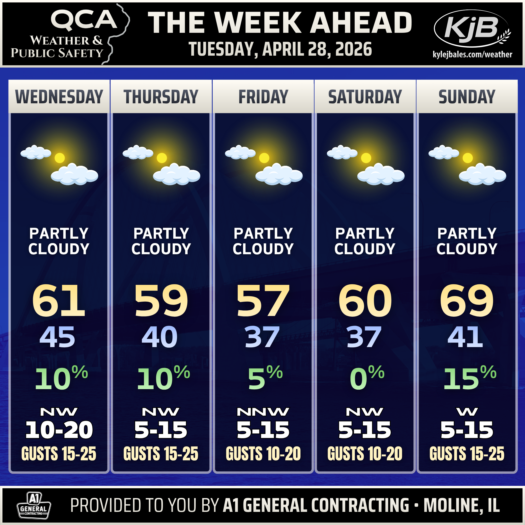
5-DAY FORECAST
NO ACTIVE OUTLOOKS
NATIONAL FORECAST
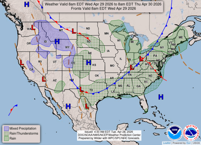
WEDNESDAY APRIL 29 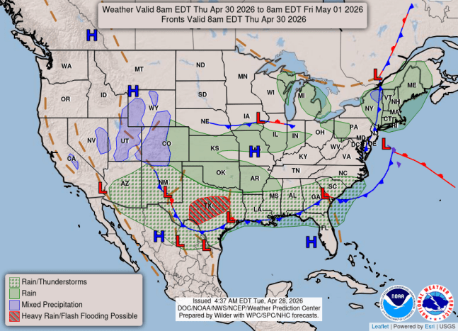
THURSDAY APRIL 30
EXTENDED FORECASTS
CLIMATE DATA
MOLINE, ILLINOIS
Quad-City Airport
April 28, 2026
Normal High: 68°
Normal Low: 45°
APRIL PRECIPITATION
Month to date: 6.00″
Normal: 3.35″
Since March 1st: 9.26″
Normal: 5.97″
Since Jan. 1st: 9.74″
Normal: 9.46″
APRIL SNOWFALL
Month to date: 0.0″
Normal: 1.1″
Since March 1st: 7.0″
Normal: 5.5″
Since July 1st: 27.7″
Normal: 36.1″
APRIL HISTORY
All-Time High
93° 1986
All-Time Low
7° 1982
Wettest
11.3″ 1973
Driest
0.32″ 1895
Most Snowfall
13.3″ 1997
EVENT REVIEWS
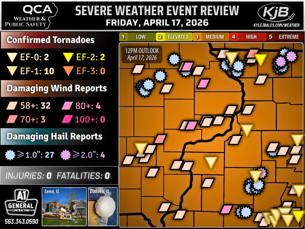
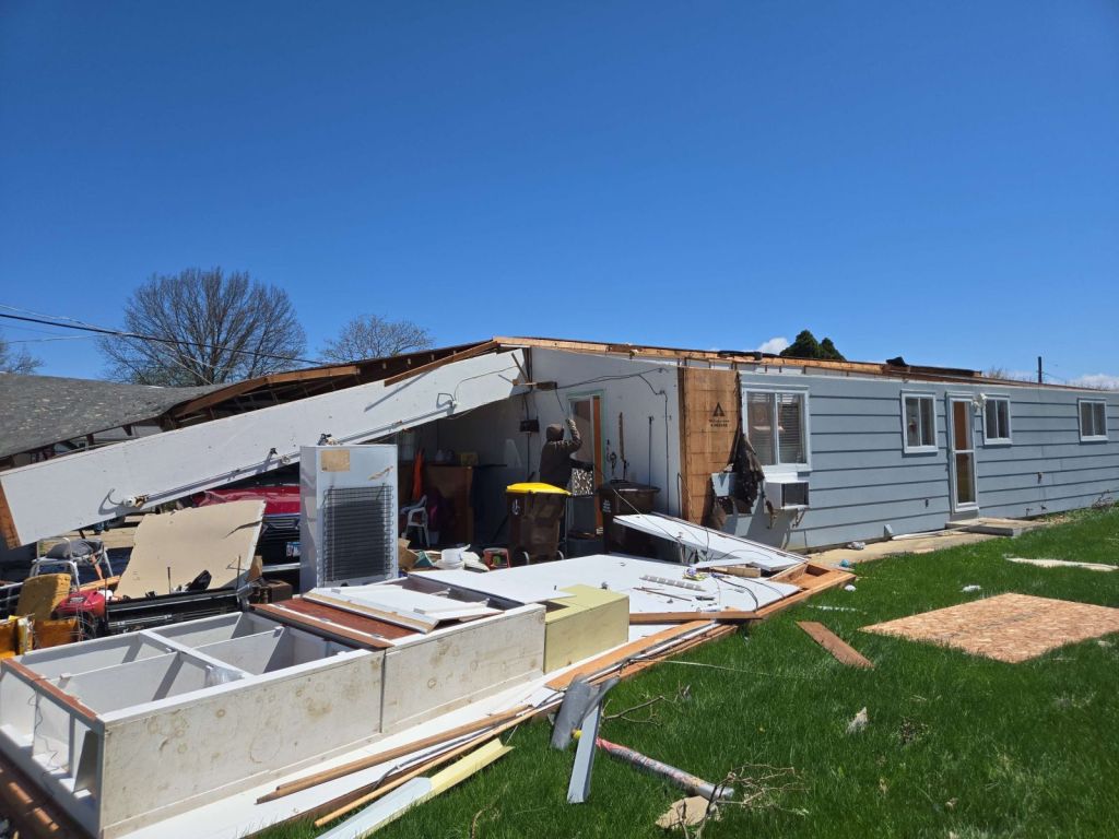
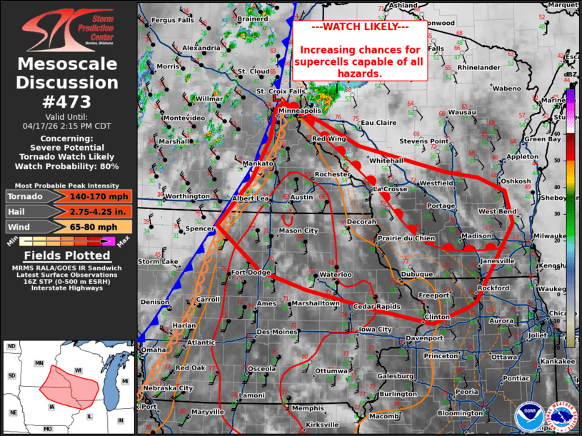
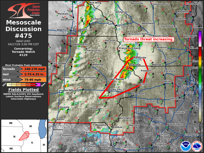
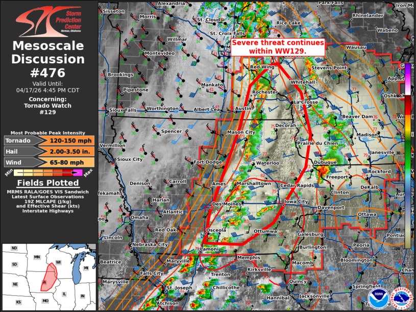
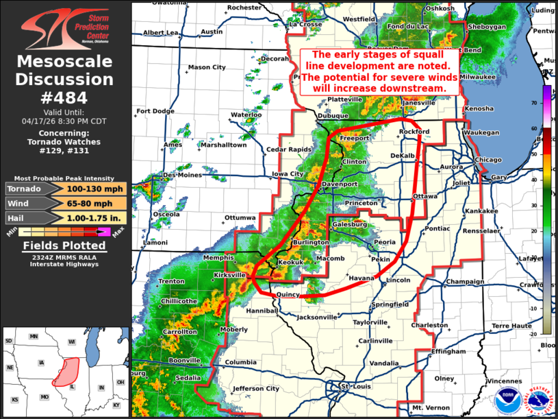
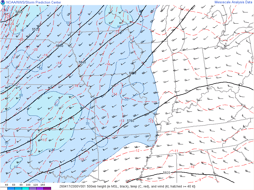
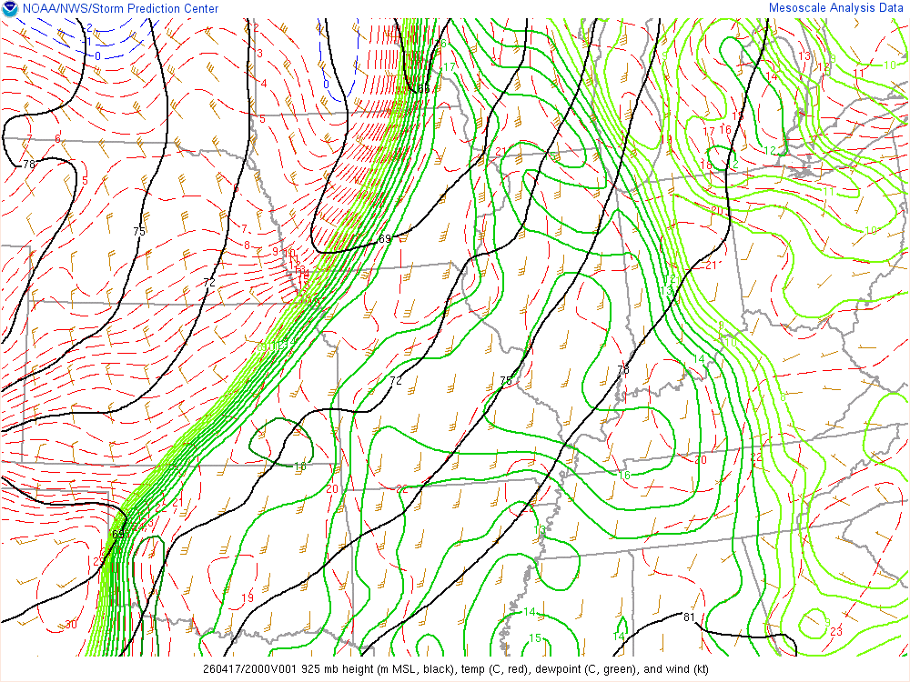
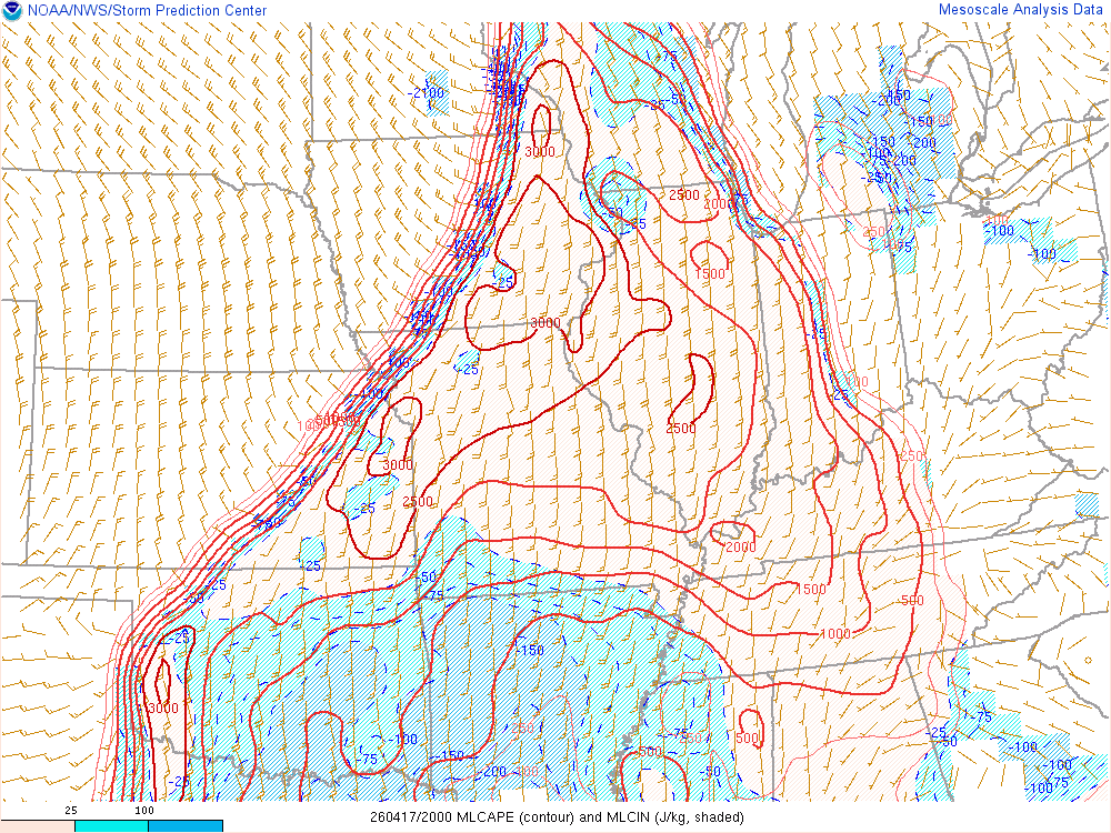
April 17, 2026
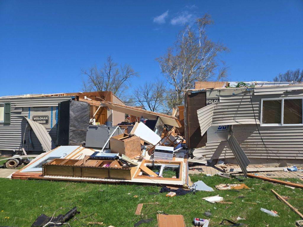
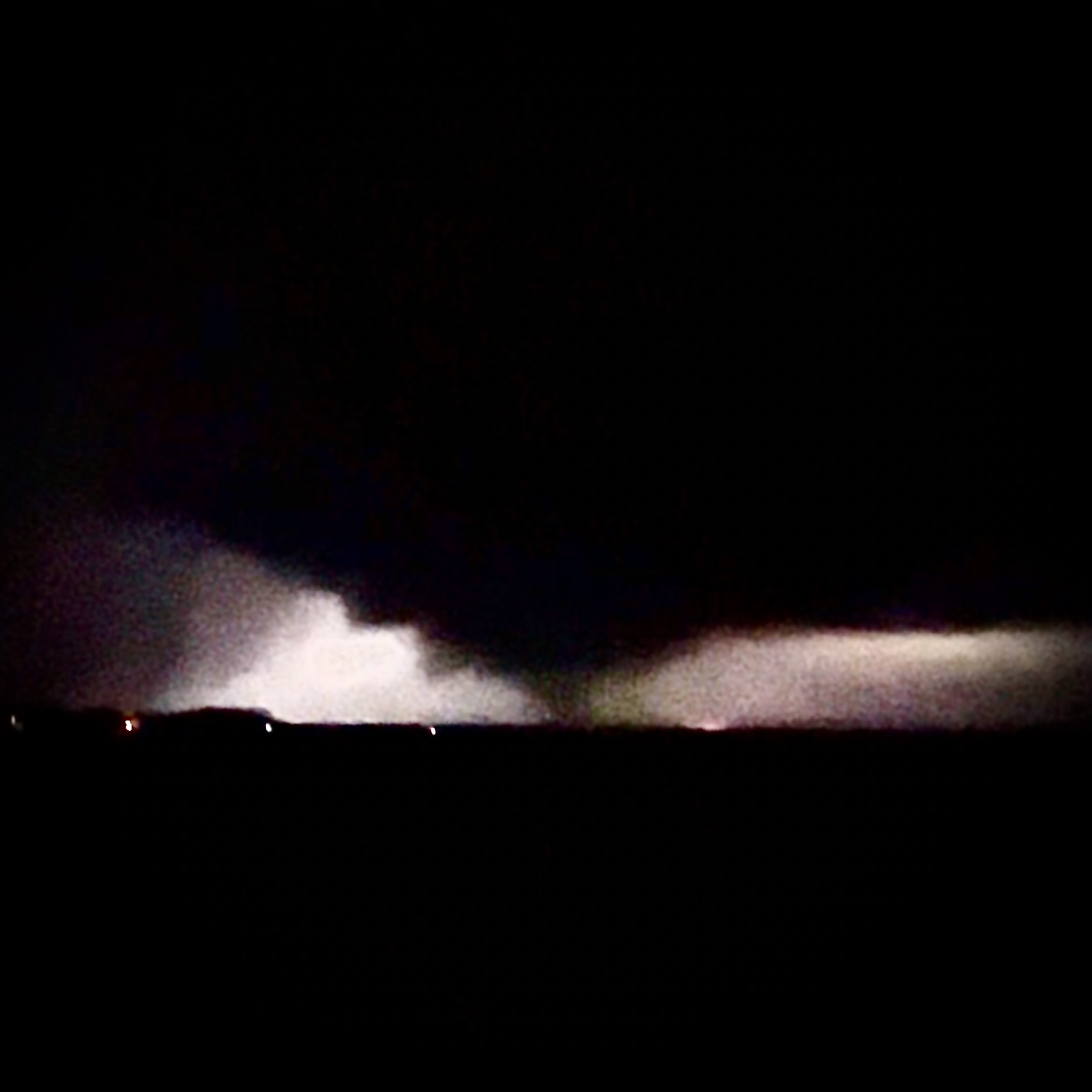
Lena EF2 Tornado
Severe Weather Outbreak
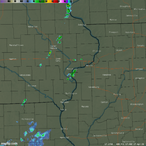
On the afternoon and evening of April 17, a major storm system traversed the Midwest bringing numerous strong to severe thunderstorms across the QCA.
The most significant damage in the QCA occurred in Lena, where many homes and outbuildings were damaged, trees uprooted, and power lines downed by an EF2 tornado.
Elsewhere, there were widespread wind gusts in excess of 60 to 80 mph, along with large hail and several tornadoes, of which caused significant property damage in many communities.
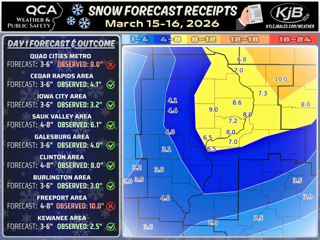
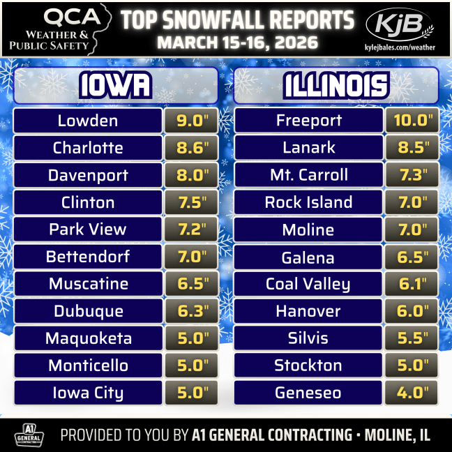
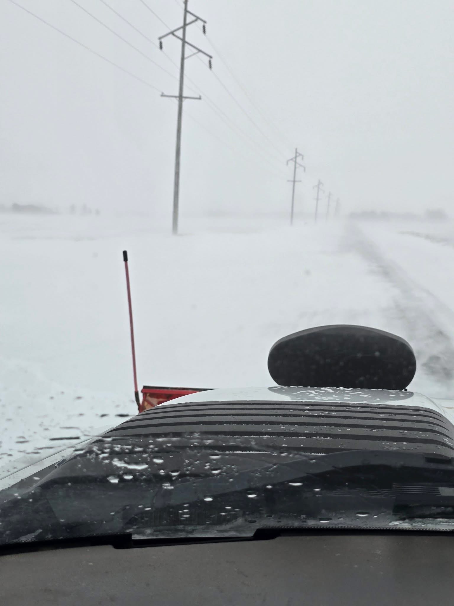
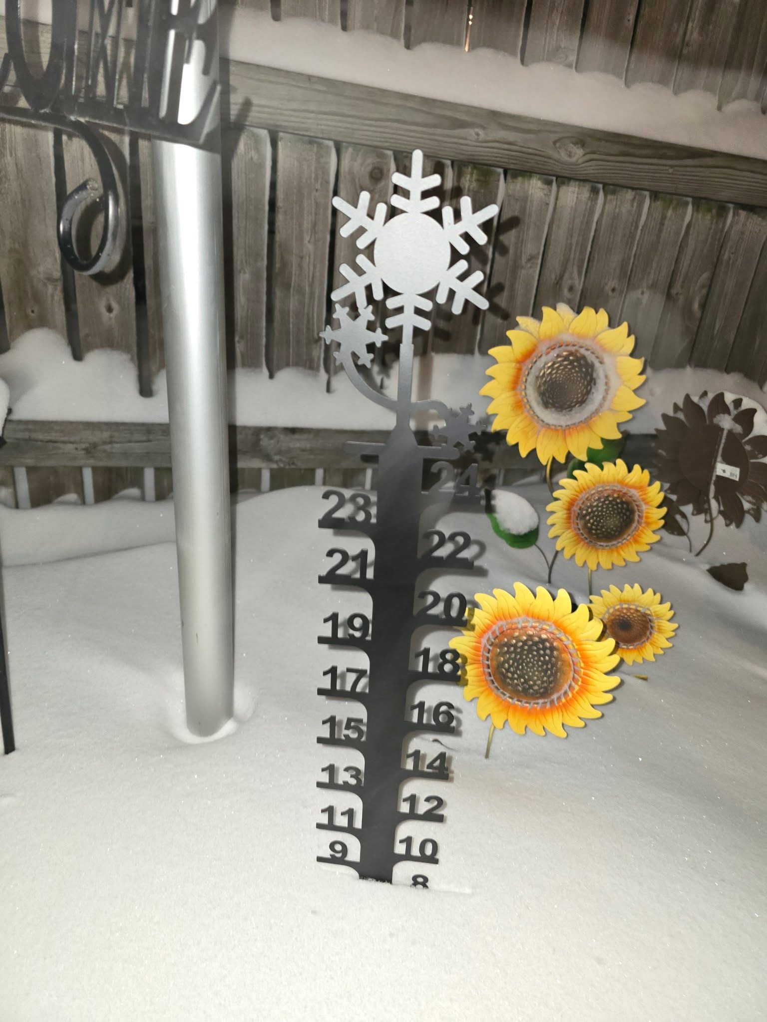
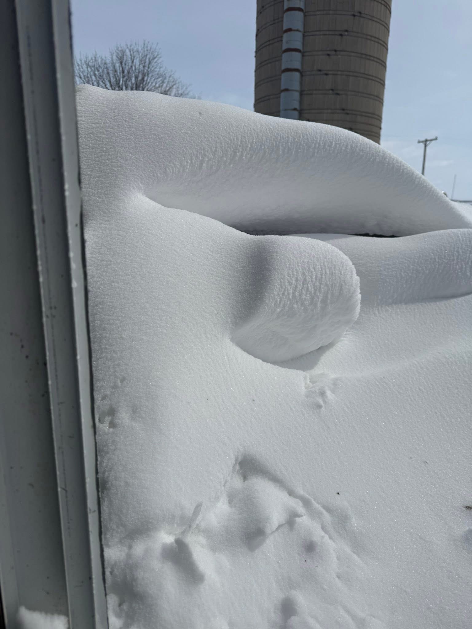
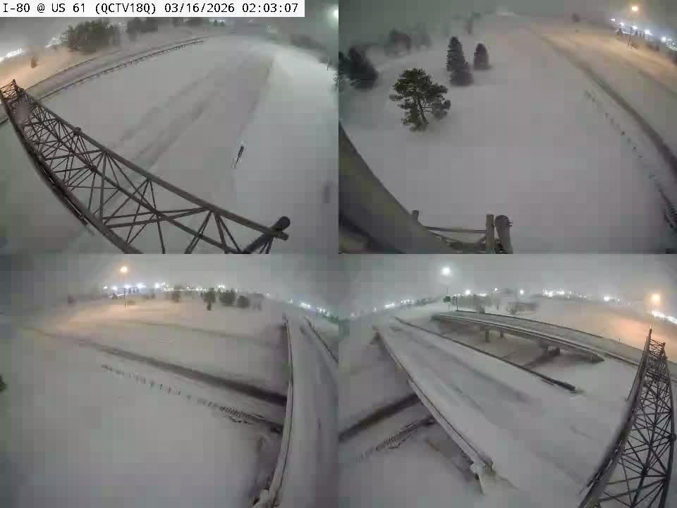
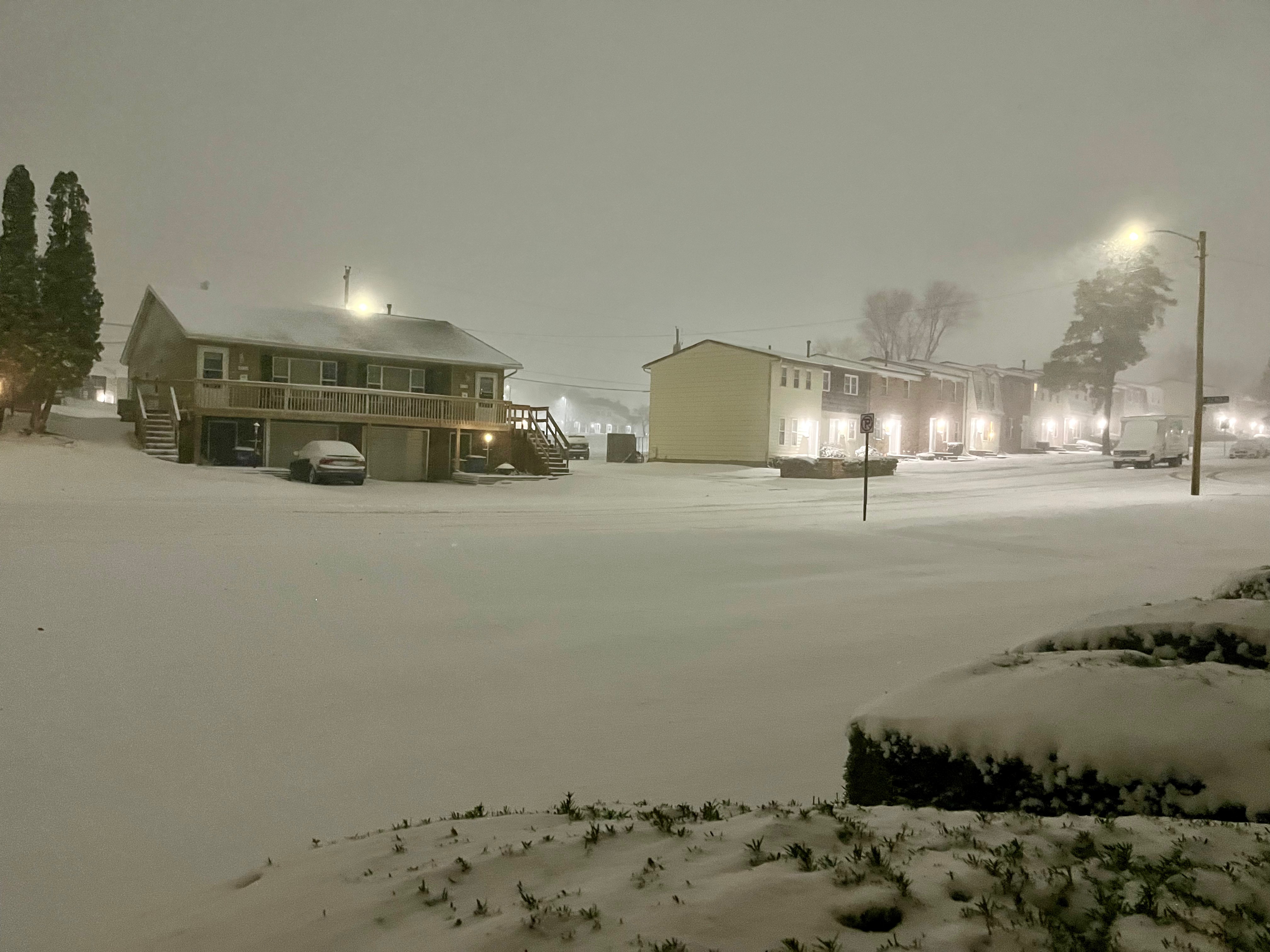
March 15-16, 2026
Blizzard
A powerful winter storm dumped 4 to 10 inches of snow with wind gusts up to 50+ mph late March 15 into March 16, which led to blizzard conditions across most of the QCA region, including the immediate Quad Cities.
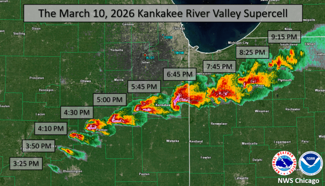
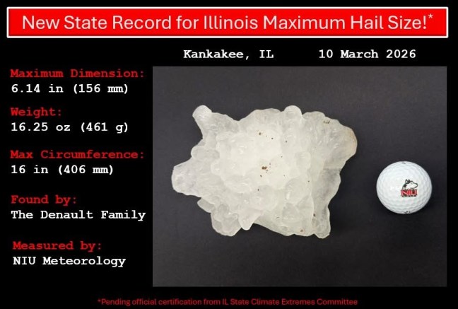
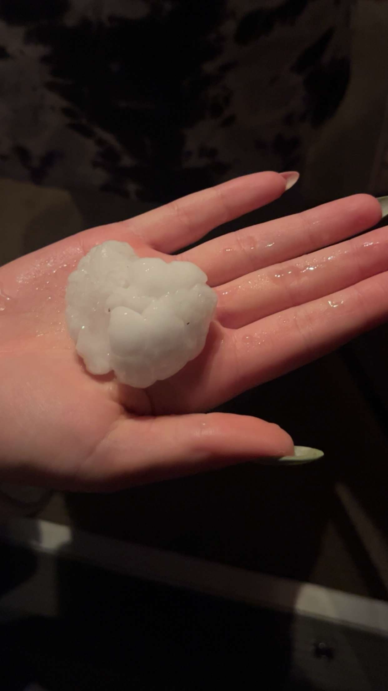
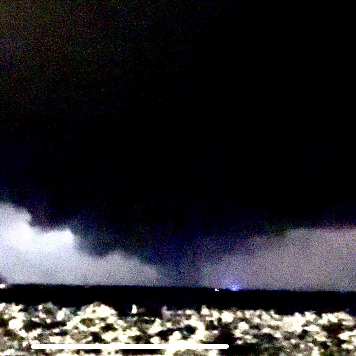
March 10, 2026
Large Hail & Tornadoes
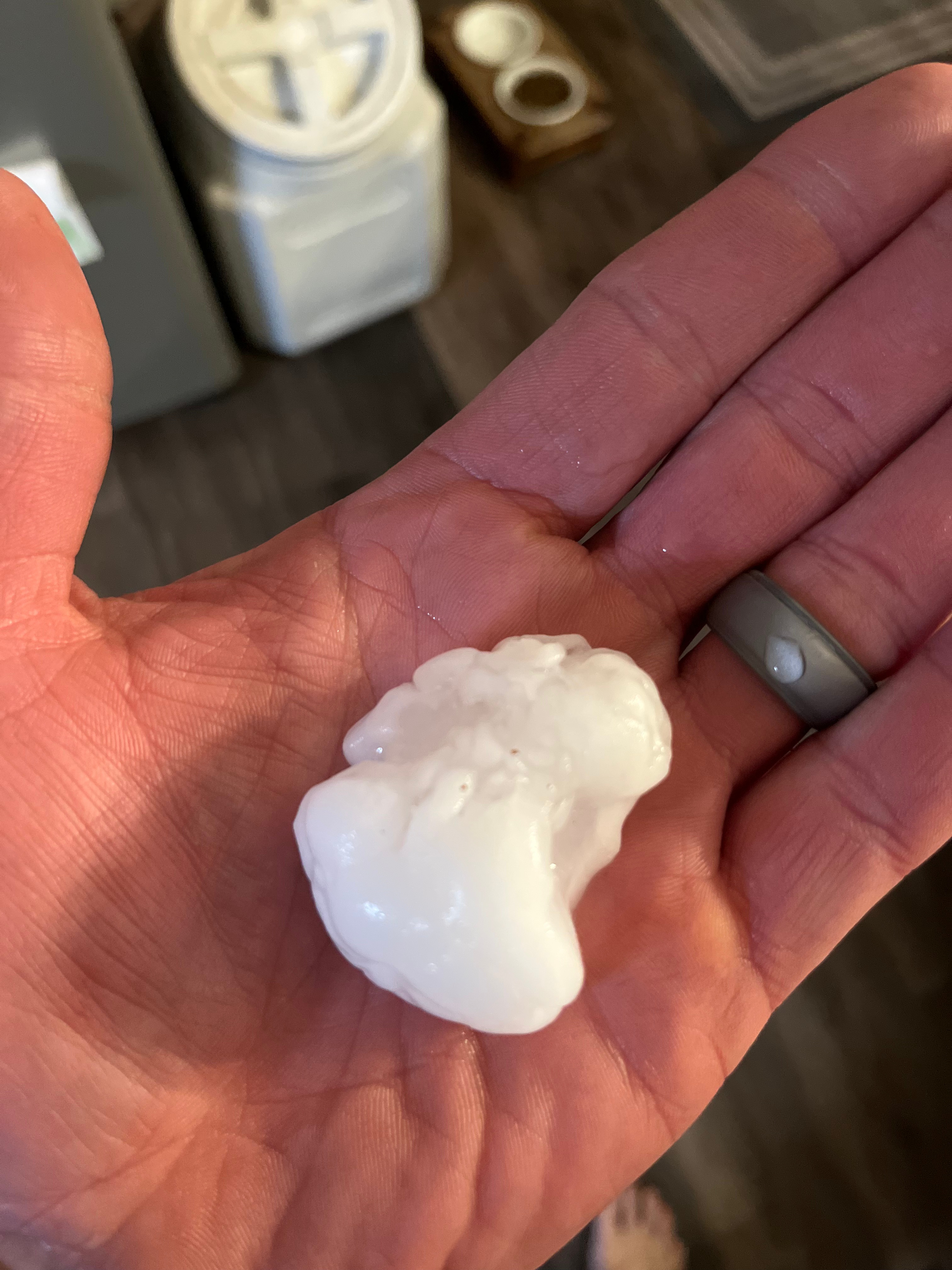
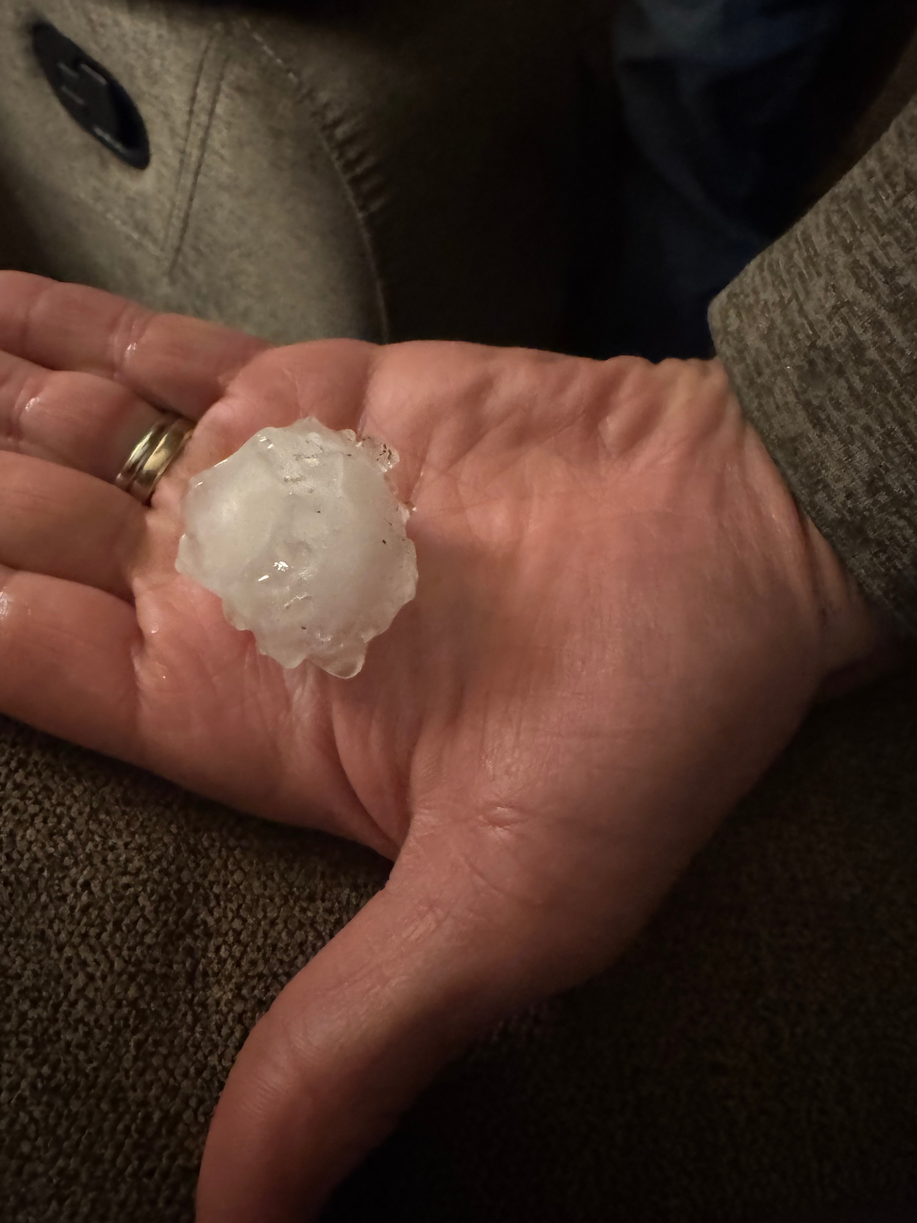
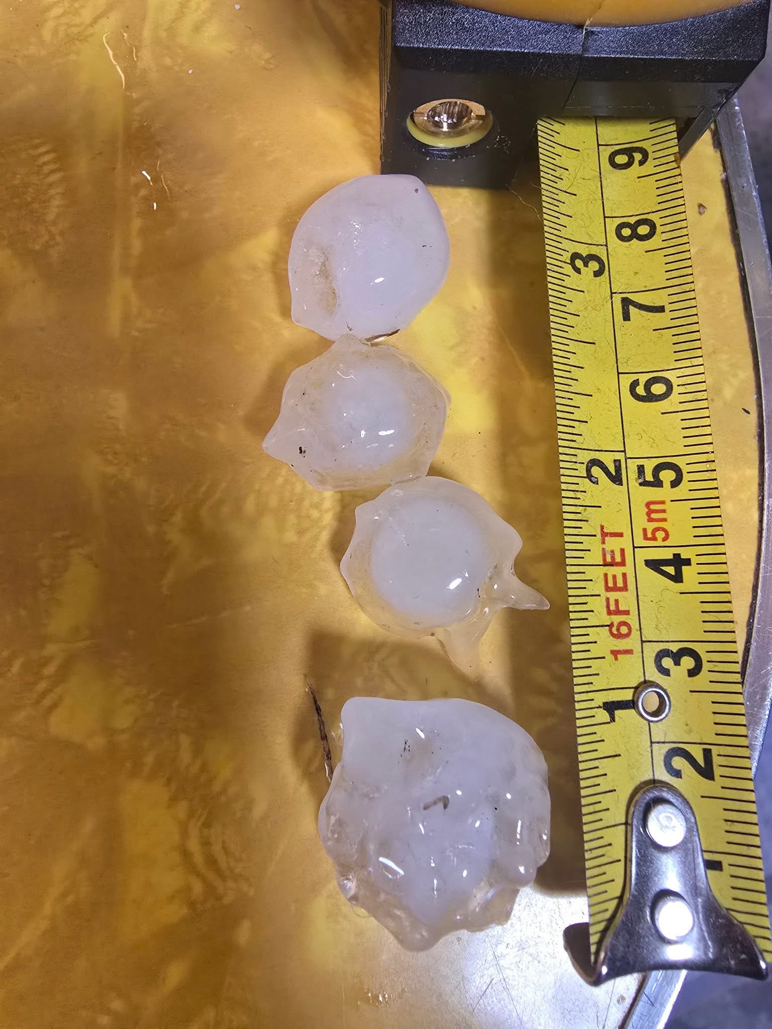
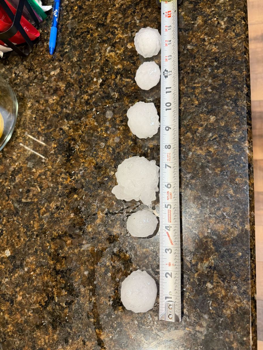
– An outbreak of severe weather occurred on the afternoon and evening of March 10, impacting large swaths of the QCA with numerous reports of large hail up to the size of baseballs, along with 6 tornadoes.
– The most significant impacts were just to our east, in the Kankakee area, where there was a long-track EF3 tornado, along with massive hail over 6″ in diameter, which is bigger than a DVD disc.
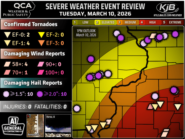
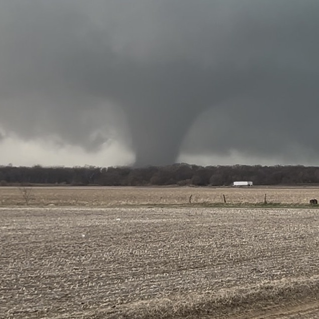
Tornado near Aroma Park, IL.
Follow QCA Weather
on Facebook
